Coastal Hazards
Climate Change and the Beach
Even paradise can't escape the reality of our changing climates. The State of Hawai'i is expected to be impacted by the continual rising of sea levels along with many other weather events. Sea level rise impacts including combined flooding from passive and coastal flood hazards can be further visualized with the interactive Kaua'i Sea Level Rise Constraint District Viewer maps. Kaua'i has become one of the first places in the country to pass planning regulations with considerations to projected sea level rise. The impacts of climate change however will affect more than the tides, with increased variability of storm patterns leading to potentially disastrous flooding impacts as was seen with the record-breaking rainfalls, and landslides witnessed during the April 2018 flood.
Our challenge is to enable our beloved beaches to persist with sea level rise. Beaches and native dune ecosystems serve an important role in protecting against storm surges and are an important natural resource for present and future generations. Preservation of traditional and customary practices and continued access to the sea for fishermen is a fundamental aspect to the livelihood of many residents.
Some policy recommendations so our beaches are not lost:
Prioritize public trust resources over the built environment in protection of our beaches
Managed retreat for structures located too close to the ocean
Rolling beach easements
Conservation easements to preserve and protect public beach access to and along the shore
Prohibition of coastal armoring
Coastal land acquisition to preserve beaches, including preservation of undeveloped beach lots
Prioritize coral reef preservation to buffer the impacts of sea level rise
Relocation, relocation, relocation
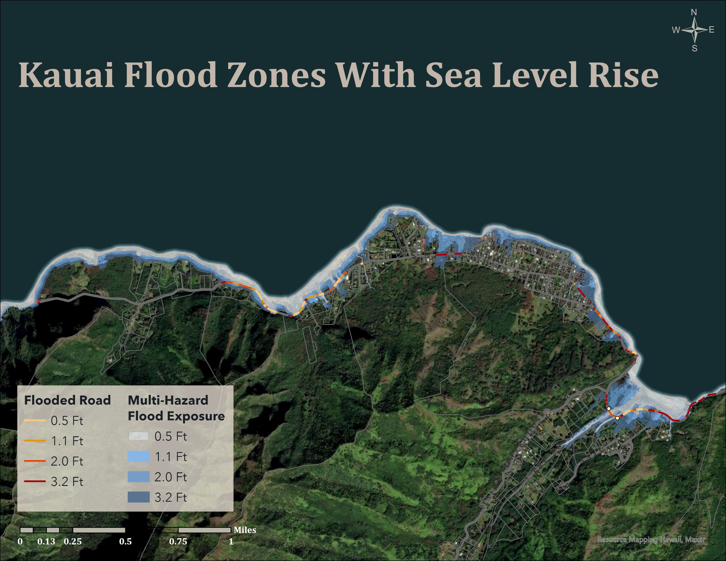
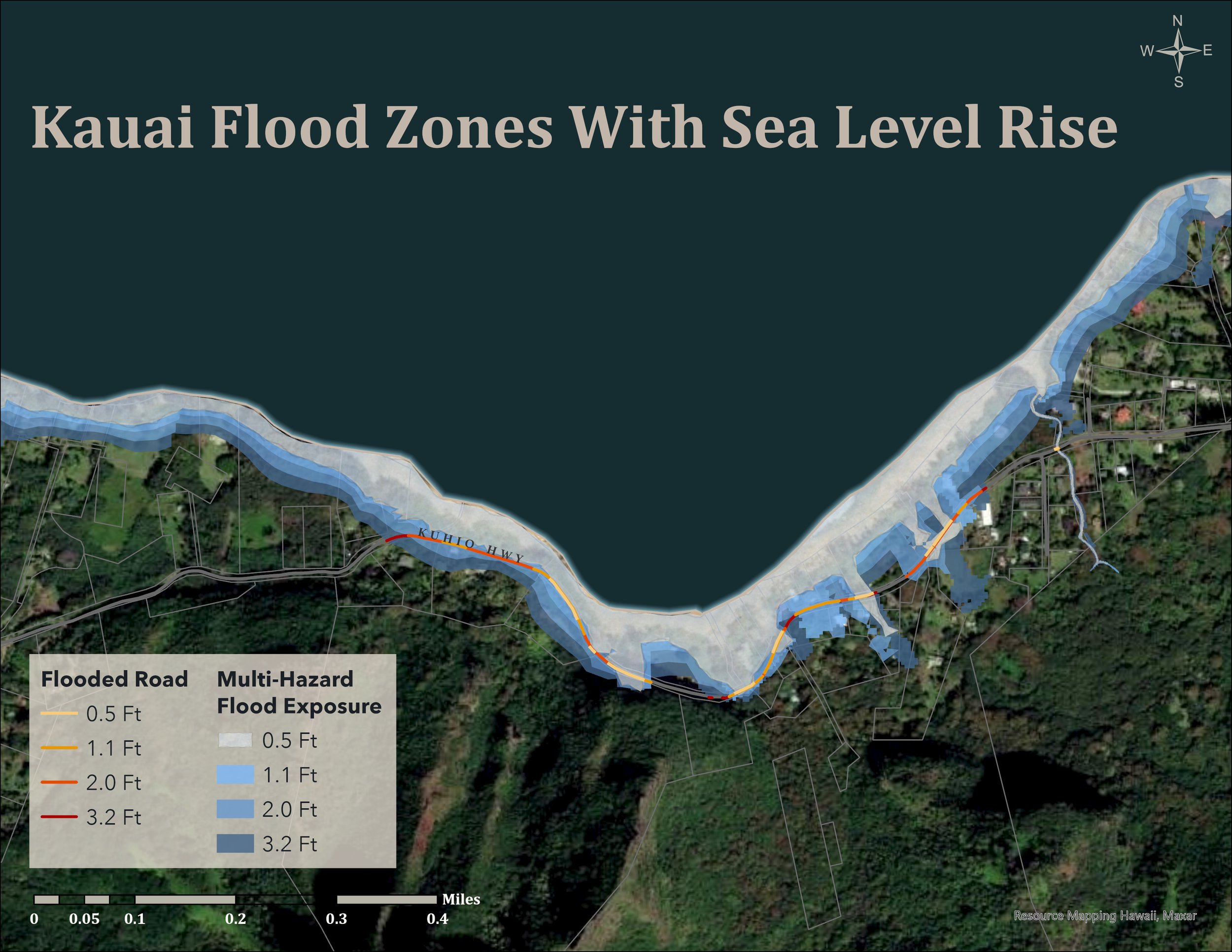
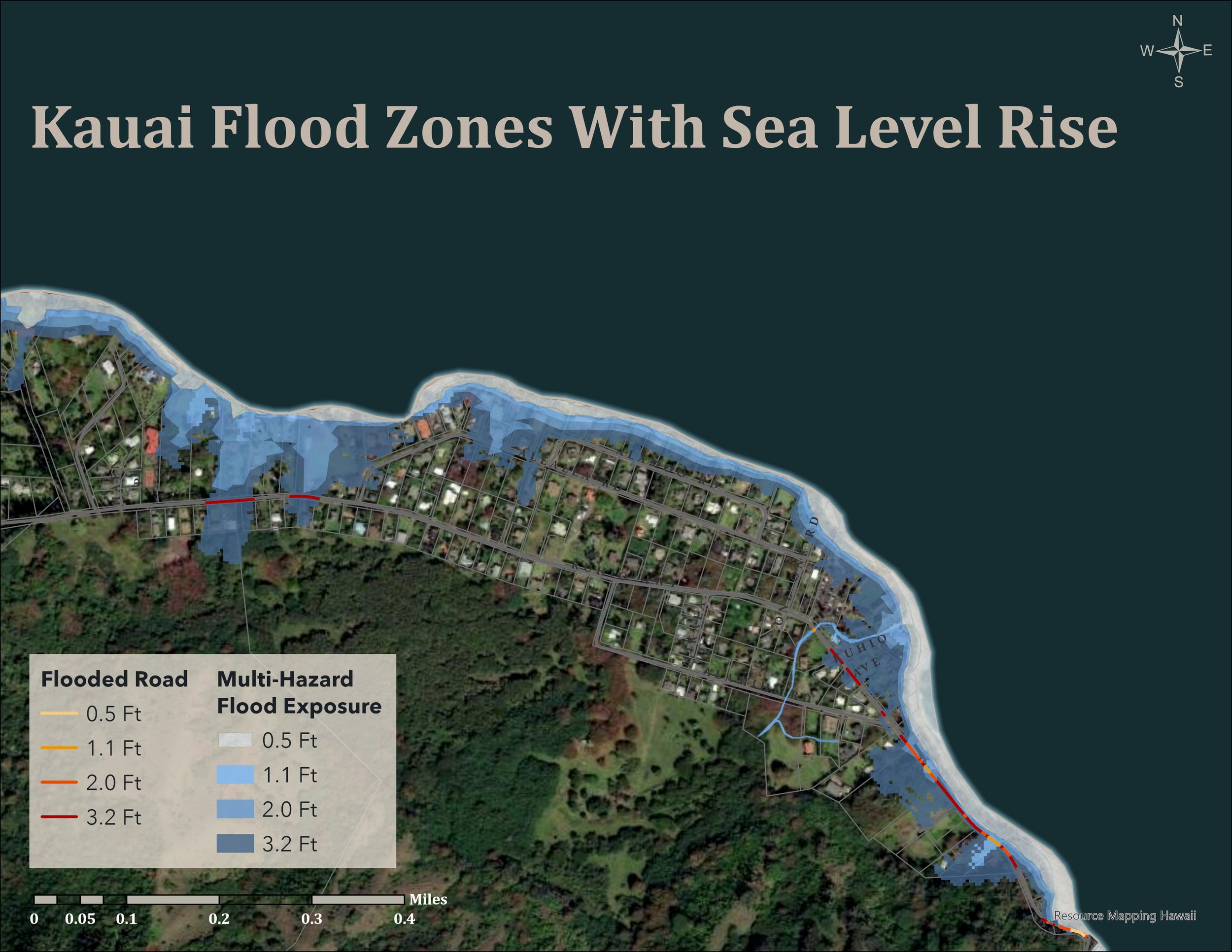
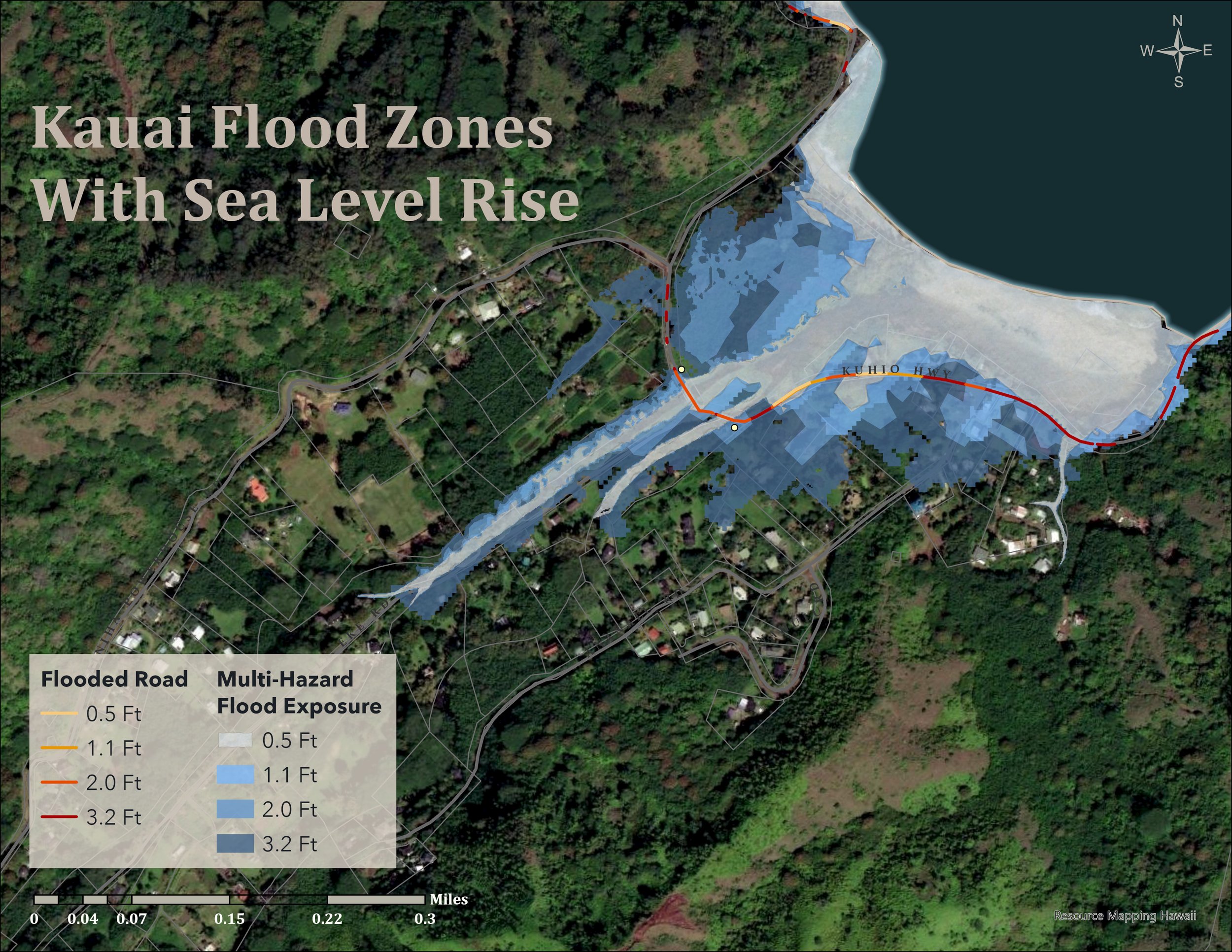
Chronic Coastal Flooding

Chronic coastal flooding is shown above by the combination of sea level rise from passive flooding, annual high wave flooding. Coastal erosion has been seen to be amplified by human impacts. The results of this erosion will cause heightened experiences of flooding for inland areas that lack native dunes to replenish beaches that would otherwise serve in buffering storm and high wave surges.
The map above looks at the combination of flood risks with sea level rise, taking into consideration both coastal flooding from high wave reaches in combination with passive flooding from rainfall.
Hurricanes
Hurricanes and tropical storms can bring excessive amounts of rain, strong and damaging winds, storm surge, high waves, erosion along shorelines, and tidal and coastal flooding. When these storms occur they can have dramatic, damaging, and potentially deadly effects. Coastal areas of the County of Kauaʻi are susceptible to damage caused by a combination of tidal surge and strong winds.

Kauai’s Recent Hurricanes
: The destructive forces of Hurricane Iwa struck Kaua'i November 23, 1982. Ten years later Hurricane Iniki made landfall on Kaua'i September 11, 1992 with sustained winds of more than 130 mph.
Storm Surge: The abnormal rise of water generated by a storm, over and above the predicted astronomical tides. Storm surge occurs when water is pushed toward the shoreline by the force of winds from the storm. This will be exacerbated by increased inundation to the land with sea level rise.
Tsunami Hazards
Tsunami waves are a great threat to life and property for all those living along or near the coastline. They are experienced as walls of water with immense force surging far into upland areas and are created by an underwater disturbance such as an earthquake, landslide, volcanic eruption, or even meteorite. A tsunami can move hundreds of miles per hour in the open ocean and can crash into land with heights of 100 feet or more. From the area where the tsunami originates, waves of energy travel outward in all directions. Once the force of this water approaches shallow depths, it can be seen to increase in height. The topography of the ocean floor and force of impact can influence the size of the wave. Areas at greatest risk are those less than 25 feet above sea level and within a mile of the shoreline.
Hā'ena - Wainiha Tsunami inundation zone
Hā'ena was greatly impacted by two tsunamis in recent history. On April 1, 1946, Hā'ena was hit with devastating waves, with a wave run-up of 45 feet in elevation. The second tsunami occurred on March 9, 1957 after an earthquake occurred in Alaska’s Aleutian Islands; the run-up was measured at 52 feet.
If you have ever visited Hā'ena and Wainiha and wondered why the houses are built up so high on stilts, it is because this area is prone to tsunami waves and flooding. Houses are built at each base flood elevation to mitigate the known hazards.
For more historical information on Hā'ena tsunami events, please visit pacificworlds.com

Wave run-up heights recorded in the 1946 Tsunami
Map above shows the historical wave run-up heights recorded in the 1946 Tsunami by Harold G. Loomis. To look at tsunamis in other years around Hawai'i check-out our interactive tsunami map.